Geospatial Applications
Geospatial data analysis provides organizations with actionable intelligence about the visual world. Our data analysts can help.
Overview
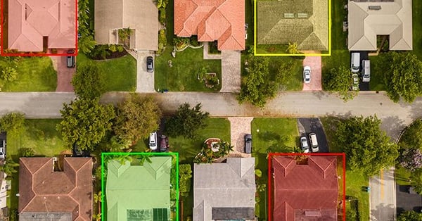
Organizations have been using traditional mapping for years to gather information about the world around them. The application of AI to geospatial data can deepen their understanding and inform how they adapt their approach in creating AI for applications such as road navigation, remote insurance assessments and pipeline inspections, and forestry management. Training and maintaining these AI systems requires large quantities of annotated geospatial data, and that’s where CloudFactory can help.

Taking the Time and Cost out of Mapping
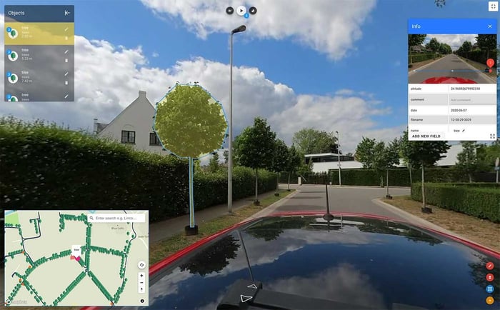
Geckomatics specializes in mobile mapping for cities and businesses that need highly accurate, up-to-date maps and inventories. Their solution provides insights on assets to improve city management and urban planning. They turned to CloudFactory to help make their cost-effective solution available to more customers around the world. Our teams of data analysts:
- Labeled and conducted QC on street-level panoramic images of trees, road signs, and other objects to create a 360-degree inventory.
- Helped Geckomatics expand from mapping 1,000 kilometers (km) in two countries to supporting clients in five countries with mapping projects totaling more than 20,000 km.

Without CloudFactory we never would have been able to deliver work for large cities. We tried with a different partnership before and it failed. Now that we have this support, we feel confident that we can deliver on all the new projects we’ll have in the future.
Bert Cattoor
Co-Founder and CEO, Geckomatics

Ready to Get Started?
Questions about training data or want to learn how CloudFactory can help lighten your team’s load?
How CloudFactory Works For You
Expand Your Team
Our managed teams have served hundreds of clients across use cases that range from simple to complex.
Quality at Scale
Our proven processes deliver quality data quickly and are designed to scale and change along with your needs.
Subscription-Based Terms
Flexible contract terms and pricing help you to get started quickly and to scale up and down as needed with no lock-in.
Recommended Reading
The 4 Biggest Hurdles for Real-Time Geospatial Data Labeling
The real-time use cases for geospatial data are practically limitless, but data-labeling remains a major challenge on such an enormous scale.
How Computer Vision Helps Us See the Future
Can AI help us predict the future of climate change, ocean sand erosion, and food production?
Nearmap | Roof Geometry
Geospatial mapping company turned to CloudFactory to help them scale their new roof geometry business.
Contact Sales
Fill out this form to speak to our team about how CloudFactory can help you reach your goals.


